Gemma GPS
Don’t get lost
Gemma GPS is the easiest app for navigation. Save your current location or add a destination and at a glance know you’re going the right way. Tag your hotel and the subway station in a new city. Tag your campground when you’re out hiking. Tag the dock and buoys when you’re boating. Anywhere you go, feel confident you’ll get back.
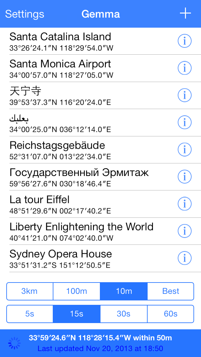
Save
Tap the plus sign to save your current location.
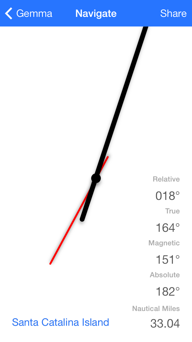
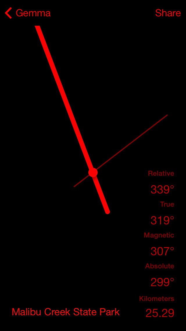
Navigate
Follow the arrow to your destination.
Settings
Change various settings.
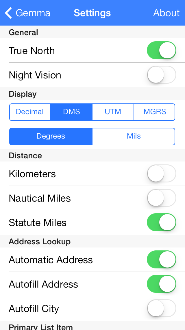
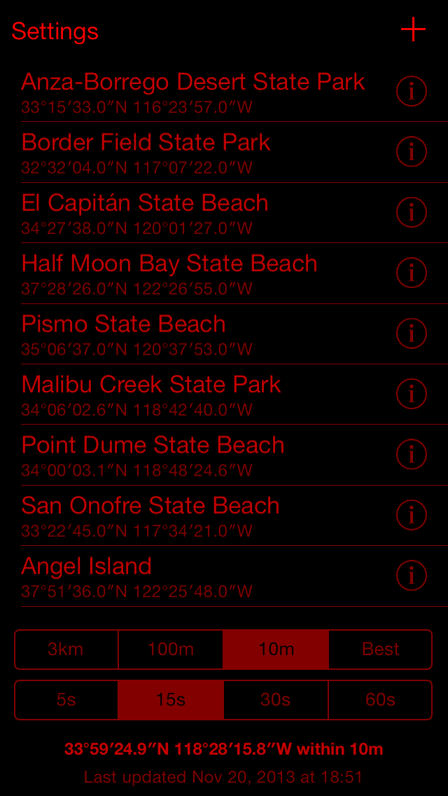
Night Vision
Turn on night vision for easy viewing in darkness.
Navigate
Tap the location name to open Maps.
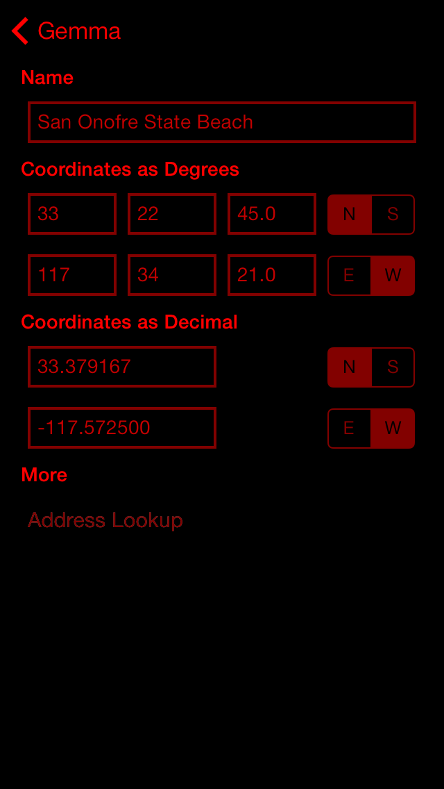
Edit
Tap the I button on the main screen to edit.
Questions, With Answers
What is Gemma GPS?
Gemma GPS is an iPhone app that shows the direction from your current location to a saved location.
Why does Gemma GPS exist?
This app was written to help people never get lost. For hikers caught out past sunset and lost a mile from their car because they walked the wrong way. For boaters that run into breakwaters because a heavy fog set in. For travelers unsure after an evening walk if their hotel is to the left or to the right.
What does it do better?
Expensive hand-held GPS devices may be powerful, but much of functionality goes unused because of their complexity. This is a simple app for people that might not know what a waypoint on a route is. Tap the plus sign to add your current location, go walking, and at any point just follow the arrow back to where you started.
Night Vision: What’s that for?
When the sun is shining, a bright interface is perfect. But at night the brilliant white screen is blinding. Toggle a switch and the Gemma GPS colors change to red on black, helping your eyes preserve their adjustment to darkness so you can still see the stars overhead and that tree stump on the trail. Gemma GPS supports an automatic night vision mode with the Sunrise Equation.
Can I use it in my native language?
Gemma GPS supports internationalization and is localized in English (English), German (Deutsch), Portuguese (Português), Spanish (Español), Italian (Italiano), Russian (русский), and Simplified Chinese (中文). French, Traditional Chinese, Arabic, Hebrew, and Swedish are coming soon.
What if I have trouble with vision?
Optimizations for VoiceOver to better support blind users were introduced in v1.3 and support for Dynamic Type resizing was added in v1.2.
How can my coordinates be displayed?
Gemma GPS stores coordinates internally as decimal pairs like 34.015833, -118.451389. It also supports degrees with minutes and decimal seconds, 34°00′57.0″N, 118°27′05.0″W, Universal Transverse Mercator, 11n 365987 3764861, and Military Grid Reference System, 11SLT6598664861. Latitude bands are displayed only for MGRS; UTM displays hemispheres.
How do I add new locations?
In the application, add a new location and then edit it with the coordinates of your destination. As of v1.5, location data can be extracted from photographs in the camera roll. Future versions will support GPX importing and exporting. The application also supports its own iPhone URL scheme, gemmagps://coordinates/ with options of either "?ll=34.9,-118.4" or "?lat=34.9&long=-118.4&name=LocationName" to import locations. A demonstation and sample set used for testing is available.
What distance options are there?
The app displays distances in kilometers (meters up to 1500), miles, or nautical miles.
Is distance based on a straight line or Great Circle?
Internally the distance between coordinates is computed with Apple’s MKMetersBetweenMapPoints which uses Great Circle. Future versions of Gemma GPS may add support for Rhumb Line angles and distances.
Does the compass support mils?
While the internal magnetic compass gives readings as degrees from 0° to 359° there is an option for conversion to NATO angular milliradians (6400 in a circle).
What about elevation?
The application saves the current altitude, vertical precision, and horizontal accuracy when adding the current location but at present does not make use of that information.
How good is the iPhone at finding my location?
The iPhone has several methods to determine your location, which correspond to options within the application. The least specific, with accuracy generally around 1km (a half-mile), uses nearby cellular towers to estimate your location. Next, the iPhone can estimate your location within about 100 meters using nearby wireless Internet access points. The most specific location comes from GPS and GLONASS, with 10 meter accuracy indoors and the best reported precision of 5 meters outdoors. The app has a configurable timer on determining your location because it may simply be impossible at times to see enough satellites for a good position, like when you’re inside a parking garage or in a deep canyon surrounded on all sides by hills.
Will this app drain my battery?
A key design consideration was to never monitor the location in the background. This app does not support breadcrumb tracking. Its purpose isn’t to let you know where you’ve already been, but to instead help you verify you’re still moving forward on course. When you’re away from cell service, it is wise to enable Airplane Mode so that your iPhone doesn’t drain the battery looking for cell towers; be mindful Airplane Mode does disable GPS too.
Is my information private?
Yes. The locations you save are stored locally on your phone and as part of your iTunes backups. Location information will be sent to Apple for address lookups (reverse geocoding) if the Address Lookup option is enabled (the default), but is otherwise never transmitted to or stored by a third party. Conversion between coordinate formats and computation of distance and direction is performed locally on the device and does not require a network connection.
How are the locations stored?
The database of locations uses Core Data. The SQLite file used by Core Data has NSFileProtectionComplete enabled to remain encrypted any time the device is locked with a passcode.
Can this app alert me when I approach or am leaving a location?
Anchor Watch and Region Monitoring may be part of an upcoming major release. Geofencing outside of urban areas without abusing the battery is a complex problem.
Version History
- 1.5: Extract GPS from EXIF data in photographs
- 1.4: Sunrise Equation for Night Vision, improved error messages
- 1.3: VoiceOver support, improvements to Night Vision and Dynamic Type
- 1.2: Dynamic Type support, MGRS and UTM added
- 1.1: Location sharing, cell display preferences
- 1.0: Initial Release
Where can I learn more about navigation?
Of course there’s Wikipedia, with information on geographic information systems and geographic coordinate systems. Private Pilot Ground School at a nearby community college is a great introduction. Boaters will find the United States Coast Guard Auxiliary’s Weekend Navigator course invaluable in making sense of charts. And then there is also the NGA App Store.
![]() Made in Los Angeles, California
Made in Los Angeles, California
© 2016 Patrick Tudor